361
361
Oct 29, 2012
10/12
by
WJLA
tv
eye 361
favorite 0
quote 0
. >> good morning from ocean city, maryland. the wind and rain and growing more ferocious by the our. behind me you can see the water crashing up closer to the sea wall we have been talking about. sand and water came crashing onto the boardwalk a moment ago. we are between 16th street and 17th street. everything's out of fear was part of the mandatory evacuation zone that was put in place if at 8:00 last night. south of here, we are hearing reports of flooding already. we are seeing water starting to pool against some of the hotels as the water is coming in from the ocean. and from the bay. wind gusts at 40 miles an hour and 50 miles an hour at the boardwalk. taking a look at what is happening, the governor says the biggest issue was going to be the storm surge. that is something they are continuing to monitor. 450 national guard troops have been called in to be on standby for whatever is needed throughout the day as we get more and more of the effects of hurricane sandy. the rain is going sideways. the water is starting to come
. >> good morning from ocean city, maryland. the wind and rain and growing more ferocious by the our. behind me you can see the water crashing up closer to the sea wall we have been talking about. sand and water came crashing onto the boardwalk a moment ago. we are between 16th street and 17th street. everything's out of fear was part of the mandatory evacuation zone that was put in place if at 8:00 last night. south of here, we are hearing reports of flooding already. we are seeing water...
160
160
Oct 26, 2012
10/12
by
WUSA
tv
eye 160
favorite 0
quote 0
the sandbags are being stockpiled in ocean city where a spokesperson says the message there, prepare but don't panic. scott broom has more from the beach in this live report. hey, scott. >> reporter: that's exactly the case, derek. nobody is pushing the panic button down here. everybody knows that they've got at least a day and a half of really good weather. so the bulk of the weekend is to make preparations. >> taking the boat out getting ready for the storm. >> reporter: in ocean city marina workers are scrambling to secure boats for nervous owners. >> get it out today and head back home, just watch it from the house. >> reporter: the city is staging sandbags, prime ministering for possible street closures and tying down rows of lifeguard chairs. on the boardwalk lots of visitors are aiming to squeeze out a full weekend and bit the storm. >> i'm going to be gone. >> we're staying for the redskins game. >> first we're going to batten down the hatches here. then we'll batten down the hatches home. >> i've got 20 it'ses of keys in my car going -- sets of keys in my car going around to
the sandbags are being stockpiled in ocean city where a spokesperson says the message there, prepare but don't panic. scott broom has more from the beach in this live report. hey, scott. >> reporter: that's exactly the case, derek. nobody is pushing the panic button down here. everybody knows that they've got at least a day and a half of really good weather. so the bulk of the weekend is to make preparations. >> taking the boat out getting ready for the storm. >> reporter: in...
136
136
Oct 26, 2012
10/12
by
WUSA
tv
eye 136
favorite 0
quote 0
we have some models going toward ocean city, others long island. then you see the loop de loop. this will be around for a while. great damage potential unfortunately monday and tuesday. this goes till wednesday now. halloween. so this could be around a while. you see today, we've got the cloudy skies. expecting a little sun later on, highs in the low 70s. take your preparations now. you have time today and tomorrow. clear the gutters, the downspouts, secure lawn furniture, garbage cans, that sort of thing. get ready. monday and tuesday could be really rough around here. i'll have the complete forecast in a few minutes. first, want to check in with our weekend meteorologist. we know you have lots of questions. he's conducting -- she's conducting a web chat. >> we have you covered from all angles. i'm hosting a live web chat. if you have any specific questions about what the storm is forecast to do. so i can give you information about what the current forecast is and what that might mean for you. specifics on is there the potential for tropical storm force winds. is there the pote
we have some models going toward ocean city, others long island. then you see the loop de loop. this will be around for a while. great damage potential unfortunately monday and tuesday. this goes till wednesday now. halloween. so this could be around a while. you see today, we've got the cloudy skies. expecting a little sun later on, highs in the low 70s. take your preparations now. you have time today and tomorrow. clear the gutters, the downspouts, secure lawn furniture, garbage cans, that...
96
96
Oct 29, 2012
10/12
by
WJLA
tv
eye 96
favorite 0
quote 0
brad has been in ocean city, md., sandy first arrived. some shelterg right now. i thought this was going to calm down. in fact, the wind speed has storm hasbecause the tooser as it came shore in new jersey. ,t is nasty looking, certainly are about half the what they were when [inaudible] blowing in.n stille you can see which way the wind blowing. are heading toward another in a few hours. we had a high tide this morning at 8:00 that was pretty dramatic. up and overoming the sea wall. pretty substantial. this is an example of the power of those waves. is one of the benches they very heavy cast-iron bench. it was drawn into this garden. as was this bench. another one over there. it is pretty much like that up and down the boardwalk. you can see some of the debris out here. you can see the sand starting to on the boardwalk as the and thecomes exposed comes walking around the buildings. -- would been around the buildings. about theconcern flooding and there was a lot of flooding in ocean city big 16 street south all the way to the image, a block behind the boardwalk,
brad has been in ocean city, md., sandy first arrived. some shelterg right now. i thought this was going to calm down. in fact, the wind speed has storm hasbecause the tooser as it came shore in new jersey. ,t is nasty looking, certainly are about half the what they were when [inaudible] blowing in.n stille you can see which way the wind blowing. are heading toward another in a few hours. we had a high tide this morning at 8:00 that was pretty dramatic. up and overoming the sea wall. pretty...
167
167
Oct 29, 2012
10/12
by
WRC
tv
eye 167
favorite 0
quote 0
. >>> this is ocean city, maryland, where the winds are whipping, as you can see. moving the rain sideways. a lot of coastal communities are feeling the brunt of the storm first. some of the residents evacuated. some are waiting the storm out, hoping the preparations they've made in terms of securing their homes will make it through. you can see the waves there and the wind. we'll bring you more updates live from rehoboth beach during the news cast. >>> and in wards 3 through 8 each have their own designated center for relief centers. the red cross will provide food and water for those seeking safe conditions during the storm. >>> if you rely on metro to get around town, you're probably not going anywhere for a few days. metro shut down all rail and bus service for today. a spokesperson for the transit system says metro will probably be closed at least for tomorrow as well. takes a while to get things going again. last time metro had such an extensive shutdown was back in 2003 during hurricane isabelle. >> i would urge customers to heed public warnings and avoid tr
. >>> this is ocean city, maryland, where the winds are whipping, as you can see. moving the rain sideways. a lot of coastal communities are feeling the brunt of the storm first. some of the residents evacuated. some are waiting the storm out, hoping the preparations they've made in terms of securing their homes will make it through. you can see the waves there and the wind. we'll bring you more updates live from rehoboth beach during the news cast. >>> and in wards 3 through...
214
214
Oct 30, 2012
10/12
by
WUSA
tv
eye 214
favorite 0
quote 0
i know some roads down in ocean city are opening back up this morning. some roads, of course, here are clearing -- some of the water is clearing from those roadways. for now, those driving restrictions are still in place. we're hoping to get word from the governor later this morning as to when folks might be able to start driving here again. >> thank you very much. >> as those winds and rain move to shore, more than 5 million people lost power up and down the east coast. >> the gusts from sandy took down untold numbers of trees. this tree took out the edge of a home. here's a run down of the power outages in our area. >> i'm liking the trend this morning. we're seeing the numbers and i just want to show you because i've been tweeting it out since last night, we were 492,000. right now 471,000. over night it was well over half a million. i just wanted to show you that trend. it's good news. at least some work is being done through out the evening. let's start out right now with bge. you can see the outage map right there in the yellow and orange. that mea
i know some roads down in ocean city are opening back up this morning. some roads, of course, here are clearing -- some of the water is clearing from those roadways. for now, those driving restrictions are still in place. we're hoping to get word from the governor later this morning as to when folks might be able to start driving here again. >> thank you very much. >> as those winds and rain move to shore, more than 5 million people lost power up and down the east coast. >>...
187
187
Oct 29, 2012
10/12
by
WJLA
tv
eye 187
favorite 0
quote 0
conditions have steadily been declining in ocean city, maryland. greg brianne carter joins us from the shore with the latest. some waves crashing overall. >> the concern in ocean city is the flooding and how much we will see over the next 24 hours. along the beach, looked at the scene behind us. incredible. we are seeing this. at this point between 16th street and 17th streets along the boardwalk, we're not seeing much of a beach. we're seeing some flooding against many of the hotel that had sandbags against the first floors in ocean city. talking about the response, we expect to get an update from ocean city officials about 10:00 this morning on the condition and the efforts underway. already this morning we have seen ocean city police and members of the national guard driving along the boardwalk to check out the conditions and to make sure nobody is out here this morning. that is the big concern, for safety and for flooding out here. talking about that in general, we have mandatory evacuations for areas south of this point where we are. 8:00 last
conditions have steadily been declining in ocean city, maryland. greg brianne carter joins us from the shore with the latest. some waves crashing overall. >> the concern in ocean city is the flooding and how much we will see over the next 24 hours. along the beach, looked at the scene behind us. incredible. we are seeing this. at this point between 16th street and 17th streets along the boardwalk, we're not seeing much of a beach. we're seeing some flooding against many of the hotel that...
128
128
Oct 30, 2012
10/12
by
WTTG
tv
eye 128
favorite 0
quote 0
so that is the latest from ocean city. back to you guys. >> all right. seeing the wind really starting to kick up and the waves too as well. thank you so much. >> always some people want to stay behind. >>> what is in store for the rest of the week? that is the big question. tucker is next with the forecast and julie has traffic. >> a reminder about another danger out there. power lines down on a vehicle. this was in kensington. a woman was trapped inside that car. the emergency workers had to rescue her. she is fine we understand this morning. let's just hope most of these stories have that sort of happy ending today. stay with us. we'll be right back. we had a good group of people. good group of employees out there. this was a booming place. and mitt romney and bain capital turned it in to a junk yard. i was suddenly, 60 years old. i had no health care. mainly i was thinking about my family. how am i going to take care of my family. he promised us the same things he's promising the united states. and he'll give you the same thing he gave us. nothing. a
so that is the latest from ocean city. back to you guys. >> all right. seeing the wind really starting to kick up and the waves too as well. thank you so much. >> always some people want to stay behind. >>> what is in store for the rest of the week? that is the big question. tucker is next with the forecast and julie has traffic. >> a reminder about another danger out there. power lines down on a vehicle. this was in kensington. a woman was trapped inside that car....
91
91
Oct 30, 2012
10/12
by
WTTG
tv
eye 91
favorite 0
quote 0
most of the damage in ocean city was caused by flooding. mackey's restaurant was inundated with water on all sides. crews today worked through the day to clear the streets while homeowners along the bay are looking to recover. >> this is the worst i've ever seen. it looks like the houses might be leaking. it pushed open the doors in the back and it's also just the entire decks are gone. >> it's the highest i've ever seen it. i've ridden out a couple of storms before, but nothing like this before. it was a little hairy. winds were blowing really hard. >> reporter: the good news in ocean city, they are not reporting any deaths or any injuries as a result of this storm. however, the national guard did have to go in and evacuate about 50 people during the storm. these were people the mayor described as having that oh oh moment in the might of the storm realizing that they needed to get out, so the national guard was able to go in, get those people and get them to safety. that's the latest here in annapolis, back to you. >> thanks. >>> it is a s
most of the damage in ocean city was caused by flooding. mackey's restaurant was inundated with water on all sides. crews today worked through the day to clear the streets while homeowners along the bay are looking to recover. >> this is the worst i've ever seen. it looks like the houses might be leaking. it pushed open the doors in the back and it's also just the entire decks are gone. >> it's the highest i've ever seen it. i've ridden out a couple of storms before, but nothing...
146
146
Oct 29, 2012
10/12
by
WRC
tv
eye 146
favorite 0
quote 0
areas around ocean city. over four inches of rain. getting into areas of delaware, over 3 inches of rain. those are the kind of rainfall amounts we're going to see before long. as, again, the center of hurricane sandy gets closer and closer to us. it's already made that turn not just to the north but towards the north and west. getting closer to the coast. you can see it there. landfall expected somewhere between delaware and the southern new jersey coast around 8:00 or 9:00 p.m. here's the latest track coming out. this should be the 11:00 p.m. track for you. to the north and west. coming ashore around areas of southern new jersey, northern delaware. then again, the storm system, we're really going to see it spread out even more. talking about 1,000 miles across the storm system affecting areas all the way from the coast, as far west as ohio. look at that heavy band of rain from norfolk through areas of d.c. pushing westward with the white stuff. yeah, that snow that's already falling in areas of west virginia. southern areas of charl
areas around ocean city. over four inches of rain. getting into areas of delaware, over 3 inches of rain. those are the kind of rainfall amounts we're going to see before long. as, again, the center of hurricane sandy gets closer and closer to us. it's already made that turn not just to the north but towards the north and west. getting closer to the coast. you can see it there. landfall expected somewhere between delaware and the southern new jersey coast around 8:00 or 9:00 p.m. here's the...
180
180
Oct 29, 2012
10/12
by
WTTG
tv
eye 180
favorite 0
quote 0
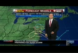
been to ocean city inlet, there in ocean city, that was caused by a hurricane in 1933. this is one of the outer bands associated with hurricane sandy working south to north there. it is just kind of pin wheeling back toward the washington area and back out to the west. parts of the area, manassas, leesburg, frederick, you haven't seen a whole lot yet. will shortly and once the rain arrives, it will be with us for the entire day. the rain rates here are going to pick up during the course of the day as the storm gets closer. we're just starting to see the rain. that will be stage one. then we'll be dealing with the winds. let me show you the big picture on sandy. when we went to bed last night. this was a weak category one hurricane. it has picked up in intensity overnight. you see the eye. you had an eye develop during the evening hours. this storm has winds of 85 miles per hour. 941millibars. that would make this a historic hurricane. when and as it gets injected with the cooler air, this hybrid storm will take off and give is heavy rain rates and dangerous winds. we ar
been to ocean city inlet, there in ocean city, that was caused by a hurricane in 1933. this is one of the outer bands associated with hurricane sandy working south to north there. it is just kind of pin wheeling back toward the washington area and back out to the west. parts of the area, manassas, leesburg, frederick, you haven't seen a whole lot yet. will shortly and once the rain arrives, it will be with us for the entire day. the rain rates here are going to pick up during the course of the...
214
214
Oct 29, 2012
10/12
by
WUSA
tv
eye 214
favorite 0
quote 0
cbs' chip reid is in ocean city covering the storm. he and his camera crew were taken out by a rogue wave. we're told everybody is okay and they were able to save the camera, too, but when bruce johnson and kristin fisher and all our other colleagues out by the beach talk about the significance and the power of that storm and how quickly it can take you, you could see by that video it illustrates that point. >> feet and feet above the other waves. >>> let's talk about power outages which have been going up and up. russ ptacek is checking those us for us with the different utilities. >> just since i last spoke to you, 40,000 more outages. on twitter you'll see these numbers that came out about five minutes ago, 138,000 now without power. bge reporting 66,000, pepco 20,000, dominion -- this is the biggest change -- 43,000 dominion customers without power, novak 1,649, smeco 4,326 and rappahannock about 3,000. let's look at dominion. that is the biggest change. those numbers may have doubled since we last spoke. here is one, this big inte
cbs' chip reid is in ocean city covering the storm. he and his camera crew were taken out by a rogue wave. we're told everybody is okay and they were able to save the camera, too, but when bruce johnson and kristin fisher and all our other colleagues out by the beach talk about the significance and the power of that storm and how quickly it can take you, you could see by that video it illustrates that point. >> feet and feet above the other waves. >>> let's talk about power...
158
158
Oct 30, 2012
10/12
by
WUSA
tv
eye 158
favorite 0
quote 0
same deal in philadelphia 47 miles per hour and 37 in ocean city new jersey. the center of the storm is just to the south of philadelphia and you can see the area where the winds are light but wrapped around that we have the very strong winds and of course since this system has winds that go counter clockwise, you have the winds coming out of the west and northwest on that side of the storm. so we have 49-mile an hour wind gusts right now an andrews, 54 and 41 in baltimore so we're not done with the winds from this storm. buzz we did have some even stronger wind guests earlier on in the evening and here is a look at some of those. maryland 67 miles per hour and at the national mall downtown in dc60 miles an hour was the peak wind guest, almost 70 for the peak in annapolis and colesville with a 70-mile an hour wind gust. so strong winds and what about the rain, top? >> impressive with the wind so far. here is a look. the good news is the hurricane force winds, the red has gone down a bit however, we still have other wind to contend with, tropical forest winds f
same deal in philadelphia 47 miles per hour and 37 in ocean city new jersey. the center of the storm is just to the south of philadelphia and you can see the area where the winds are light but wrapped around that we have the very strong winds and of course since this system has winds that go counter clockwise, you have the winds coming out of the west and northwest on that side of the storm. so we have 49-mile an hour wind gusts right now an andrews, 54 and 41 in baltimore so we're not done...
124
124
Oct 27, 2012
10/12
by
WUSA
tv
eye 124
favorite 0
quote 0
anywhere from 58-73-mile an hour winds will be buffetting ocean city, bethany and points north. so we'll keep you posted on this. we're going to come back and talk about things you can do before the storm hits and we'll also give you a little better idea of when it will move into the metro area. >> topper, when you look at the size of that thing, you have to ask are you prepared to weather something of that magnitude. >> so we went out tonight and made an impromptu visit to one couple's home to see how prepared they are. >> reporter: tonight we're in maryland where we walked up to this house and found a very nice couple who didn't mind us coming in and bringing our experts to find out if they're really prepared for sandy. so let's go. come on. what are you going to be looking for here in this house to make sure you're prepared. >> any type of water damage because of a sump pump failing. >> reporter: do you think you've well-prepared. >> yes, we are. we have lanterns, flashlights, we have an emergency radio. we have a good sump pump. >> if the electricity goes out, this sump pump
anywhere from 58-73-mile an hour winds will be buffetting ocean city, bethany and points north. so we'll keep you posted on this. we're going to come back and talk about things you can do before the storm hits and we'll also give you a little better idea of when it will move into the metro area. >> topper, when you look at the size of that thing, you have to ask are you prepared to weather something of that magnitude. >> so we went out tonight and made an impromptu visit to one...
191
191
Oct 30, 2012
10/12
by
WTTG
tv
eye 191
favorite 0
quote 0
we've been covering ocean city quite a bit. and really the storm packed a powerful punch. >> and continuous rain and high winds causing flooded roads and tree damage. fox 5's lauren demarco is live there now with a look at sandy's impact on that area. good morning to you once again, lauren. >> reporter: good morning. we continue to feel the impact with the heavy weekends and a little bit of sand in my eyes this morning. it feels like the rain has let up. very, very light, barely a drizzle but it is still very windy and cool. the ocean still raging but the waves not anywhere near as high as we saw during the height of the storm yesterday. so that is some good news. nothing coming up to the seawall at this point. i do believe that we've got some photos of those waves that crashed over the seawall on to the boardwalk. we had significant flooding on the boardwalk itself and on to the streets. viewers had sent in some rather amazing pictures of some of that and also of the flooding in the downtown area. everything below 17th street
we've been covering ocean city quite a bit. and really the storm packed a powerful punch. >> and continuous rain and high winds causing flooded roads and tree damage. fox 5's lauren demarco is live there now with a look at sandy's impact on that area. good morning to you once again, lauren. >> reporter: good morning. we continue to feel the impact with the heavy weekends and a little bit of sand in my eyes this morning. it feels like the rain has let up. very, very light, barely a...
136
136
Oct 26, 2012
10/12
by
WUSA
tv
eye 136
favorite 0
quote 0
this particur time we have no plans to evacuate ocean city. we have to makedecisions with regard to our residents and visitors. we'll certainly be prepared to do so. >> reporter: so the time frame down here is take advantage of the good weather while they ve it. it looks like if they'll have to make some serious decisions, they'll be doing that starting saturday evening into sunday so people can make plans and move if that's what the decision is going to be. that's a similar situation throughout the communities up and down the coast here in maryland and also in delaware. in fact, this weekend at rehoboth beach a big civic celebration called the sea witch -- that's a halloween theme event -- that's going to draw 20 to 30,000 people into town in rehoboth and there are no plans to cancel that now, but folks will have to watch very carefully and i think a lot of people will want to leave the coast sometime early to mid-sunday. reporting live at ocean city scott broom, 9 news now. >> yeah. those plans may need to change. thank you. >>> echoing what
this particur time we have no plans to evacuate ocean city. we have to makedecisions with regard to our residents and visitors. we'll certainly be prepared to do so. >> reporter: so the time frame down here is take advantage of the good weather while they ve it. it looks like if they'll have to make some serious decisions, they'll be doing that starting saturday evening into sunday so people can make plans and move if that's what the decision is going to be. that's a similar situation...
121
121
Oct 27, 2012
10/12
by
WJLA
tv
eye 121
favorite 0
quote 0
sandy is putting everyone on the east coast on alert and creating worry in ocean city. the concern is for beach erosion and flooding. plenty of work is being done ahead of the arrival of the storm. they have been in communication with state officials to get extra resources. >> with less than 48 hours until sandy is expected, state leaders are urging residents to not waste time getting prepared. the governor says the storm could create headaches for people all week. there could be several days without power. this will be a hardship for people there will be some people in those conditions. people are shopping and getting ready. it is critical that people get what they needgovernment donald and governor o'malley have already declared states of emergency. >> cruise sounds nice to get away from the looming mess. holland america had to end a 13- day cruise early in florida as a precaution. the final destination was to be fort lauderdale. the company is helping passengers get where they need to be. the navy is getting ready for standing by heading out to sea. 26 ships have bee
sandy is putting everyone on the east coast on alert and creating worry in ocean city. the concern is for beach erosion and flooding. plenty of work is being done ahead of the arrival of the storm. they have been in communication with state officials to get extra resources. >> with less than 48 hours until sandy is expected, state leaders are urging residents to not waste time getting prepared. the governor says the storm could create headaches for people all week. there could be several...
237
237
Oct 29, 2012
10/12
by
WUSA
tv
eye 237
favorite 0
quote 0
wind gusts ocean city 47, boston 49, laguardia 53 miles per hour. we talked about this all weekend and even some of last week that the breadth of the storm is so large. that's what makes this storm so dangerous and damage in the fact that it's large and a very strong storm. winds 51 mile-per-hour gusts in martinsburg, 53 in winchester, 51 downtown, 51 down towards pax river and across the bay a 41 mile-per-hour wind gust in easton. the wind field 10:00 tonight we could well have hurricane force winds over the district, anne arundel county, southern maryland, prince george's county, just about everybody till you get back to fairfax and maybe up into parts of frederick and loudoun county. the orange is no picnic. the orange are winding from 40 to 73 -- winds from 40 to 73, so they're still damaging as well. even by 3:00 in the morning we'll have damage winds from new york well south of us almost down to fredericksburg with a little bulls identify hurricane force winds pushing -- bull's eye of hurricane force winds pushing north of town into southern s
wind gusts ocean city 47, boston 49, laguardia 53 miles per hour. we talked about this all weekend and even some of last week that the breadth of the storm is so large. that's what makes this storm so dangerous and damage in the fact that it's large and a very strong storm. winds 51 mile-per-hour gusts in martinsburg, 53 in winchester, 51 downtown, 51 down towards pax river and across the bay a 41 mile-per-hour wind gust in easton. the wind field 10:00 tonight we could well have hurricane force...
232
232
Oct 30, 2012
10/12
by
WJLA
tv
eye 232
favorite 0
quote 0
ocean city began cleanup as soon as the wind died down. it is something they are proud of here. >> mother nature had us if you times really hard in this city knows how to bounce back. >> the ocean city fishing piers have gone. it was washed away by waves. >> you can still feel it shaking, so i can imagine what it was like last night. the whole right side is off. >> along the boardwalk, it seems wash the sand is the only problem, but the businesses that operate down from the walkway took a hit. serve came crashing through and now boarded up windows and the famous san bar is also a soggy sand filled shamble. >> a few days ago this place was opened for business and doing great. now it's just crazy. >> there is flooding damage for more than 60 blocks. at this trailer park, a boat floated free for several blocks but missed all of the trailers. downtown, this building was not scared. like a lot of people, they have work to do. >> i was worried in years past. i knew we going to have issues this year. i feel fortunate. i guess we were lucky. peopl
ocean city began cleanup as soon as the wind died down. it is something they are proud of here. >> mother nature had us if you times really hard in this city knows how to bounce back. >> the ocean city fishing piers have gone. it was washed away by waves. >> you can still feel it shaking, so i can imagine what it was like last night. the whole right side is off. >> along the boardwalk, it seems wash the sand is the only problem, but the businesses that operate down from...
161
161
Oct 29, 2012
10/12
by
WTTG
tv
eye 161
favorite 0
quote 0
this is a live shot at route 50 in the ocean city drawbridge. you can see the camera shaking as the winds flop. it's 9:26, we'll be right back. [ earnest ] out of the blue one day, we were told to build a 30-foot stage. gathered the guys and we built that 30-foot stage, not knowing what it was for. just days later, all three shifts were told to assemble in the warehouse. a group of people walked out on that stage and told us that the plant is now closed and all of you are fired... i looked both ways, i looked at the crowd, and...we all just lost our jobs. we don't have an income. mitt romney made over 100 million dollars by shutting down our plant and devastated our lives. turns out that when we built that stage, it was like building my own coffin, and it just made me sick. [ male announcer ] priorities usa action is responsible for the content of this advertising. >>> up no new york city, wall street is shuttle down because of the hurricane. many financial companies like american express are closing up shop and banks including goldman sacs and
this is a live shot at route 50 in the ocean city drawbridge. you can see the camera shaking as the winds flop. it's 9:26, we'll be right back. [ earnest ] out of the blue one day, we were told to build a 30-foot stage. gathered the guys and we built that 30-foot stage, not knowing what it was for. just days later, all three shifts were told to assemble in the warehouse. a group of people walked out on that stage and told us that the plant is now closed and all of you are fired... i looked both...
235
235
Oct 29, 2012
10/12
by
WRC
tv
eye 235
favorite 0
quote 0
they're at 40 in ocean city. the rain is starting to come down. the water has picked up significantly out in the ocean. we're three to four feet above normal. again, this is just a taste of what we will be experiencing here along the coast. we spoke with many residents here in rehoboth that said they are not taking the chance. a lot of people told us the only thing they have to compare it to is the ash wednesday storm of '62 for those here along the coastal region, a they will not take those same chances as that storm of '62 because meteorologists have said this is going to be significantly larger. some of the new models showing this is now a system that's about 900 miles across. it is something that is really going to be epic. governor jack marckel saying that people should not take any chances. seven shelters are set up in the ate of delaware, three in rehoboth, and two of them are taking pets. >> if you're going to a shelter, you need to realize you're getting space on the floor. you need a sleeping bag, pillow, books. there is limited food her
they're at 40 in ocean city. the rain is starting to come down. the water has picked up significantly out in the ocean. we're three to four feet above normal. again, this is just a taste of what we will be experiencing here along the coast. we spoke with many residents here in rehoboth that said they are not taking the chance. a lot of people told us the only thing they have to compare it to is the ash wednesday storm of '62 for those here along the coastal region, a they will not take those...
143
143
Oct 30, 2012
10/12
by
WRC
tv
eye 143
favorite 0
quote 0
today, ocean city maryland is lonesome and gray. the national guard's presence a sobering real of what happened here. for shop owners, the trail of debris and wet mess means more work. >> we stand back for most hurricanes. with this, what are you going to do? >> reporter: pool of water frame the shot of the landmark ferris wheel in the distance. >> we took a buggy ride through town and everything and that was great. that was a week ago. now it looks like it is dead. >> reporter: and probably some of the most significant damage if not the most visible is here at the oc fishing pier. what appears to be stilts in the water is where the pier collapsed. like a dog gnawing on a bone, battering waves chewed away at the beach. sandy obliterated dunes and pushed the sand into what was once a lot of giving treasure trackers something to hunt. >> why are not you at home? >> my house is underwater. i can't do anything. >> reporter: erica gonzalez, news4. >>> here we go. we're going to open up the season. we're going to the last year's champion.
today, ocean city maryland is lonesome and gray. the national guard's presence a sobering real of what happened here. for shop owners, the trail of debris and wet mess means more work. >> we stand back for most hurricanes. with this, what are you going to do? >> reporter: pool of water frame the shot of the landmark ferris wheel in the distance. >> we took a buggy ride through town and everything and that was great. that was a week ago. now it looks like it is dead. >>...
146
146
Oct 30, 2012
10/12
by
WTTG
tv
eye 146
favorite 0
quote 0
a number of families were evacuated today throughout ocean city. they decided to stay and if just became too dangerous and they -- it just became too dangerous and they called for emergency responders to get them into some shelters. we've got several feet of water in the streets. half the pier is gone. we could have even more damage there, but we couldn't get down to the pier to see exactly how bad the damage is as of tonight. by daylight in the morning we should be able to get a better picture of things. from what we're hearing there is extensive damage throughout ocean city, most of that again due to flooding. we have seen that the seawall here where we're at has mainly held up, that seawall built after hurricane gloria. here where the seawall is protecting them we haven't seen too much as far as damage to the businesses along the boardwalk. there has been some sand and overwash onto the boardwalk. for the most part the businesses are okay. further up north in ocean city what we're seeing is that area where we really just have the sand dunes as t
a number of families were evacuated today throughout ocean city. they decided to stay and if just became too dangerous and they -- it just became too dangerous and they called for emergency responders to get them into some shelters. we've got several feet of water in the streets. half the pier is gone. we could have even more damage there, but we couldn't get down to the pier to see exactly how bad the damage is as of tonight. by daylight in the morning we should be able to get a better picture...
221
221
Oct 29, 2012
10/12
by
WUSA
tv
eye 221
favorite 0
quote 1
this is where landfall is happening right about there in ocean city, new jersey. the wind field is very extensive, 51-mile an hour wind gusts at reagan national, 55 at ocean city, maryland, 31 miles an hour in albany, new york, and boston, 52-mile an hour wind gusts. so the tropical storm winds are way far away from the center of this storm. as it continues to move inland, we will see these wind gusts increase. right now this is just the tip of the iceberg, 48 miles an hour in leesburg, 44 in baltimore, 43 in annapolis, 48 miles per hour in easton and the big number on the map now is still at reagan national at 51 miles per hour. when you have those big winds, you have big waves as well. most of these numbers are right around 20 feet, put as we're watching the landfall of sandy, that's where the biggest waves are. that's the one good part about this storm, topper, as you know is that since we are on the side of the storm where the winds are coming from the west, we won't see as much storm surge, especially after this storm makes landfall. >> one silver lining, alb
this is where landfall is happening right about there in ocean city, new jersey. the wind field is very extensive, 51-mile an hour wind gusts at reagan national, 55 at ocean city, maryland, 31 miles an hour in albany, new york, and boston, 52-mile an hour wind gusts. so the tropical storm winds are way far away from the center of this storm. as it continues to move inland, we will see these wind gusts increase. right now this is just the tip of the iceberg, 48 miles an hour in leesburg, 44 in...
177
177
Oct 29, 2012
10/12
by
WRC
tv
eye 177
favorite 0
quote 0
ocean city now, gusting up to 56 miles per hour. and that expected to pick up, again, throughout the evening hours. lighter winds west, but those winds will pick up here, too. that's the reason why they've got blizzard warnings up for western maryland, west virginia. temperatures stay on the cool side today. then tomorrow, about 54 degrees, and still some lingering rain as we get into wednesday. jim, pat, back to you. >> v.j., thank you. >> thank you, veronica. we're going to take a break now. we remind you we are live streaming throughout the afternoon and into the evening throughout the coverage of this storm in fact. and we want to remind you to send us your pictures. right now, here's a picture of the 14th street bridge. send us your picks anncr: it's said that character is what we do... when we think no one is looking. mitt romney: believe that they are victims. anncr: mitt romney thought no one was looking when... he attacked forty-seven percent of americans. his companies shipped jobs overseas. his plan cuts millionaires' tax
ocean city now, gusting up to 56 miles per hour. and that expected to pick up, again, throughout the evening hours. lighter winds west, but those winds will pick up here, too. that's the reason why they've got blizzard warnings up for western maryland, west virginia. temperatures stay on the cool side today. then tomorrow, about 54 degrees, and still some lingering rain as we get into wednesday. jim, pat, back to you. >> v.j., thank you. >> thank you, veronica. we're going to take a...
136
136
Oct 30, 2012
10/12
by
WUSA
tv
eye 136
favorite 0
quote 1
city's fishing pier once stood. >> it's kind of devastating. >> reporter: but it's ocean city's back streets, those on the bayside of this barrier island that suffered the most from an eight foot storm surge and 74-mile-per-hour winds. a pontoon boat was a block inland near 352nd street. >> could have been worse though. >> reporter: on the boardwalk business owners assessed damage from flooding that topped the concrete seawall here. >> this is the water going over the seawall. i was scared. i was thinking like we were really going to get totally surrounded by water. >> most of the damage is on the bayside i think. >> reporter: but the mayor says the city is well positioned to recover quickly. >> probably the highest water we've had in the back basin since hurricane gloria. we have a lot of boat docks and a lot of decks, a lot of boats i think that probably have been damaged due to that. >> reporter: on the ocean front it's basically the clean-up. there's some sand up there. there's some minor debris basically sea grass and things like that. but all the benches are back in place and t
city's fishing pier once stood. >> it's kind of devastating. >> reporter: but it's ocean city's back streets, those on the bayside of this barrier island that suffered the most from an eight foot storm surge and 74-mile-per-hour winds. a pontoon boat was a block inland near 352nd street. >> could have been worse though. >> reporter: on the boardwalk business owners assessed damage from flooding that topped the concrete seawall here. >> this is the water going over...
190
190
Oct 28, 2012
10/12
by
WTTG
tv
eye 190
favorite 0
quote 0
first, let's take a live picture of route 50 at the draw bridge in ocean city. you can see the rain coming down right now, cameras shaking a bit, winds picking up. update on sandy's track, which we come back. ♪ ♪ ♪ [ male announcer ] combine the pnc cashbuilder visa credit card with a qualifying pnc performance select checking account and earn 75% more than cards earning 1% cash back on almost everything. earning 1% cash back we had a good d group of people. good group of employees out there. this was a booming place. and mitt romney and bain capital turned it in to a junk yard. i was suddenly, 60 years old. i had no health care. mainly i was thinking about my family. how am i going to take care of my family. he promised us the same things he's promising the united states. and he'll give you the same thing he gave us. nothing. anncr: priorities usa action is responsible for the content of this advertising. . >>> well, hurricane sandy could cut off power to thousands in virginia. we'll get more now on preparations in the commonwealth. joining me on the phon
first, let's take a live picture of route 50 at the draw bridge in ocean city. you can see the rain coming down right now, cameras shaking a bit, winds picking up. update on sandy's track, which we come back. ♪ ♪ ♪ [ male announcer ] combine the pnc cashbuilder visa credit card with a qualifying pnc performance select checking account and earn 75% more than cards earning 1% cash back on almost everything. earning 1% cash back we had a good d group of people. good group of employees out...
201
201
Oct 26, 2012
10/12
by
WUSA
tv
eye 201
favorite 0
quote 0
again montauk to about ocean city. we're going to watch this. as we get closer to the event, anything farther south, that is bad news. farther north and east better news. still it's going to be a rainy, windy period for the first period of next week. even sunday looks like the rain will be moving in with the front approaching from the west and the moisture from the south. this morning clouds, patchy fog and spotty drizzle. 50s and 60s to start your day. by noon still cloudy, 65. like yesterday i think we'll get some afternoon sun. 71 degrees. a little bit of fog in the mountains. quarter mile visibility in peteestburg and salisbury. but just reduced visibilities, nothing too horribly in the metro. frederick 59. 59 in cambridge. the cool spots in the mid-50s. we're holding on to pretty uniform air mass. outside on our michael & son weather camera, low clouds but decent visibility still in d.c. with 63 degrees. cloudy skies. a light north, northeasterly wind and the humidity way up there at 87%. i want to show you the futurecast. it's ereading the
again montauk to about ocean city. we're going to watch this. as we get closer to the event, anything farther south, that is bad news. farther north and east better news. still it's going to be a rainy, windy period for the first period of next week. even sunday looks like the rain will be moving in with the front approaching from the west and the moisture from the south. this morning clouds, patchy fog and spotty drizzle. 50s and 60s to start your day. by noon still cloudy, 65. like yesterday...
213
213
Oct 26, 2012
10/12
by
WJLA
tv
eye 213
favorite 0
quote 0
this is the centerline of the cone, just north of ocean city and rehoboth, moving slowly. rain, wind, power outages, and floods all possibilities if this develops according to the computer models. tomorrow is a good preparation day. the bulk of the storm develops later monday, through the day tuesday, with heavy wind and rain. >> we will continue to follow sandy's track at how people are preparing for this unusual october storm. at 6:00, from annapolis to alexandria and d.c., more of the preparations and concerns. >> 200 snowplows hit the streets in prince toward discounting. no, this is not for the hurricane, this is an annual dry run. the yearly practice allows the crews to evaluate procedures and make sure communication is clear once the first snowflakes of what to arrive. >> this weekend, a new national christmas tree will be planted on the lips. the tree was removed in may after dying from transplant shock, so a new 28-foot colorado spruce is being brought from virginia. the national tree lighting plans for december come register for a lottery to get a ticket until 10
this is the centerline of the cone, just north of ocean city and rehoboth, moving slowly. rain, wind, power outages, and floods all possibilities if this develops according to the computer models. tomorrow is a good preparation day. the bulk of the storm develops later monday, through the day tuesday, with heavy wind and rain. >> we will continue to follow sandy's track at how people are preparing for this unusual october storm. at 6:00, from annapolis to alexandria and d.c., more of the...
213
213
Oct 29, 2012
10/12
by
WRC
tv
eye 213
favorite 0
quote 0
tropical storm force out there toward the ocean city, maryland. this is what you can expect for your day on your monday. rain increasing. wind, 20, 30 miles an hour. 7:00 a.m. around noon. heavy rain. with wind of 30 to 40 miles an hour. stronger gusts. and then around 5:00, very heavy rain. and dangerous wind. gusts upward of 60 to 70 miles per hour. we have a whole shrew of watches and warnings out there, right now. chuck bell, storm center four with the latest on what to expect. chuck. >> thank you, doug. yes, indeed. high wind warnings posted all across the air y herea. they begin over the course of the next couple days. start at 8:00 tomorrow morning. here you can see the area, under the high wind warning. these go from 8:00 on your monday morning. to 8:00 on your tuesday night. now, as far as how much wind, and when. tropical storm force wind. that is a sustained wind of 39 miles an hour or higher. that qualifies as tropical storm force wind. they could reach the d.c. metro area and be in the d.c. metro area, from about 5:00 monday afternoon
tropical storm force out there toward the ocean city, maryland. this is what you can expect for your day on your monday. rain increasing. wind, 20, 30 miles an hour. 7:00 a.m. around noon. heavy rain. with wind of 30 to 40 miles an hour. stronger gusts. and then around 5:00, very heavy rain. and dangerous wind. gusts upward of 60 to 70 miles per hour. we have a whole shrew of watches and warnings out there, right now. chuck bell, storm center four with the latest on what to expect. chuck....
136
136
Oct 31, 2012
10/12
by
WTTG
tv
eye 136
favorite 0
quote 0
. >>> ocean city took a beating. guess we're not going to do that story. which story you guys want to do? >>> all right. let's go to karen gray houston. she has more on a tree that fell into a house. >> reporter: brain and shea cameron are survivors. it's a miracle really they are alive. >> the tree as it came through the living room extends to the 18-month-old's -- crushed the crib, so luckily she wasn't in there. >> your sister is the nurse that helped my child out. >> reporter: shea was on the couch in the living room. brian was cooking in the kitchen. their two children were playing in a hallway when the huge tree next-door came crashing right down the middle of their house. >> it was like lumber cracking and obviously it was a big bang cracking and then i turned around. all i success of insulation flying. >> reporter: they heard scream -- saw was on insulation flying. >> reporter: they heard -- saw was insulation flying. >> reporter: they heard scream and crying. it was the children. >> she got the scratching on the face from the sheetrock was the wor
. >>> ocean city took a beating. guess we're not going to do that story. which story you guys want to do? >>> all right. let's go to karen gray houston. she has more on a tree that fell into a house. >> reporter: brain and shea cameron are survivors. it's a miracle really they are alive. >> the tree as it came through the living room extends to the 18-month-old's -- crushed the crib, so luckily she wasn't in there. >> your sister is the nurse that helped my...
354
354
Oct 29, 2012
10/12
by
WRC
tv
eye 354
favorite 0
quote 0
. >> these are live pictures from ocean city, maryland, where the mayor ordered a mandatory evacuation of parts of that coastal community. good morning and welcome to "news 4 today." i'm eun yang. >> good morning. i'm aaron gilchrist. it is monday, october 29th, 2012. we're tracking hurricane sandy. all major public school systems in d.c., maryland, and virginia are closed this morning. the same goes for most private schools right now. the federal government also cled. all nonessential employees should stay at home. most major local governments also closed in maryland and virginia along with the d.c. government, and metro shut down all rail services, all bus services for the first time since 2003. marc, vre also closed today. and amtrak says its northeast corridor is shut down. a complete list for you at the bottom of your screen and at nbcwashington.com. >> let's che in with storm team 4 meteorologist tom kierein right now. as you take a look outside at reagan national airport, almost all of the flights here at the local airports at reagan national, dulles, and bwi are cancelled. be s
. >> these are live pictures from ocean city, maryland, where the mayor ordered a mandatory evacuation of parts of that coastal community. good morning and welcome to "news 4 today." i'm eun yang. >> good morning. i'm aaron gilchrist. it is monday, october 29th, 2012. we're tracking hurricane sandy. all major public school systems in d.c., maryland, and virginia are closed this morning. the same goes for most private schools right now. the federal government also cled. all...
180
180
Oct 28, 2012
10/12
by
WRC
tv
eye 180
favorite 0
quote 0
we're seeing tropical storm-force winds in ocean city of 41 miles per hour. we did see a 50-mile-an-hour gust a little bit earlier. here is the gust that we're going to see, the potential wind. sunday, tonight, not too bad. upwards of 20 miles an hour. watch by tomorrow we start to get into the mid-30s over there towards the bay, but tomorrow afternoon into tomorrow evening, gusts to potentially 60 to maybe 70 miles per hour in some locations. this is going to be really tomorrow night i think the worst of this will be between noon tomorrow and midnight or rather noon tomorrow and 8:00 a.m. on tuesday morning. so we've got a long way to go here before the winds start to calm down. the other thing, the flooding. 5 to 10 inches of rain, we're going to see that likely in many parts of the area, so expect to see flooding and river flooding is going to be likely, and then tidal flooding along the potomac, along the chesapeake. 1 to 3 feet above high tide. we're talking about the potential for moderate flooding right now and it could become even worse. this is what
we're seeing tropical storm-force winds in ocean city of 41 miles per hour. we did see a 50-mile-an-hour gust a little bit earlier. here is the gust that we're going to see, the potential wind. sunday, tonight, not too bad. upwards of 20 miles an hour. watch by tomorrow we start to get into the mid-30s over there towards the bay, but tomorrow afternoon into tomorrow evening, gusts to potentially 60 to maybe 70 miles per hour in some locations. this is going to be really tomorrow night i think...
146
146
Oct 26, 2012
10/12
by
WUSA
tv
eye 146
favorite 0
quote 0
just about everything making that turn again from around montauk point down toward ocean city. we have to watch this one. let's talk about today's forecast. the bus stop forecast. we've got clouds out there, some spoy drizzle, patchy fog, 50s and 60s. sunrise 7:29. for today we start like yesterday with cloudy skies. midday still cloudy65. but this afternoon some sunshine should break out in spots. that will boost us to about 71. winds east at a to 10. fog a little bit of a problem. south-of-town now, mile and a half in stafford. quarter mile in petersburg. easton doing a little bit better but we still have sissibility issues -- have visibility issues on the eastern shore. 59 in easton. 61 hagerstown. 64 fredricksburg. so fairly uniform temperatures. outside on our michael & son weather camera, there are the low clouds moving in toward d.c. with 63 degrees and cloudy skies and a light northeast wind. we'll watch the clouds break up some this afternoon. i just want to steal a few seconds. i've got to show this because by saturday, we're not bad through the middle of the day. sat
just about everything making that turn again from around montauk point down toward ocean city. we have to watch this one. let's talk about today's forecast. the bus stop forecast. we've got clouds out there, some spoy drizzle, patchy fog, 50s and 60s. sunrise 7:29. for today we start like yesterday with cloudy skies. midday still cloudy65. but this afternoon some sunshine should break out in spots. that will boost us to about 71. winds east at a to 10. fog a little bit of a problem....
135
135
Oct 30, 2012
10/12
by
WRC
tv
eye 135
favorite 0
quote 0
. >> ocean city, maryland, hit especially hard by wind and rain from sandy, and it made for a close call from one reporter. wbal-tv's reporter and his cameraman were walking down 42nd street reporting on conditions there when the wind gave him a little bit of a scare. take a look at this. looks like we're having trouble with that video. >> they've been doing a good job about it. showed you out on coastal highway. whoa! mac, you all right? holy cow. there it goes. all right. we'll send it back to you guys in the studio. >> the best way to handle that. i was sitting, having dinner last night in the hotel, and the guy at the bar was like, i don't understand why these tv stations send these reporters out in the storm. it's a dangerous type of work you could end up doing if you're not safe. most of the time we make sure we're covered by buildings the best we can be, that we've looked around to see if there's debris that could come loose. >> but in every situation you just can't tell what danger might come to you. this is a particular case where it's such a close call. you can laugh about it a
. >> ocean city, maryland, hit especially hard by wind and rain from sandy, and it made for a close call from one reporter. wbal-tv's reporter and his cameraman were walking down 42nd street reporting on conditions there when the wind gave him a little bit of a scare. take a look at this. looks like we're having trouble with that video. >> they've been doing a good job about it. showed you out on coastal highway. whoa! mac, you all right? holy cow. there it goes. all right. we'll...
177
177
Oct 29, 2012
10/12
by
WTTG
tv
eye 177
favorite 0
quote 0
though a look at ocean city, maryland, again, high tide. very dangerous out there. surf very high out there now. >>> all right still knead our next half hour, from the beach to the big apple, how other parts of the east coast are getting ready for sandy's wrath. >>> it is now 8:26, you're watching fox 5 morning news, we'll be right back. hey! hey, baby. [ starts car ] were you eating smoked sausage in here? no! no. could have gotten me one. i did. try the unmistakable flavor of dunkin' donuts' smoked sausage breakfast sandwich. it's deliciously irresistible. hurry in today. the smoked sausage breakfast sandwich is only at dunkin' donuts for a limited time. grab one today. >>> we are back now with 8:29, and for anyone just joining us, here's a reminder for you, most schools, the federal government, the dc government all closed today. and all metro service has been suspended. we have the full list of closures and delays scrolling at the top of the screen and on our website. >> all right we to want get updated on what's happening w
though a look at ocean city, maryland, again, high tide. very dangerous out there. surf very high out there now. >>> all right still knead our next half hour, from the beach to the big apple, how other parts of the east coast are getting ready for sandy's wrath. >>> it is now 8:26, you're watching fox 5 morning news, we'll be right back. hey! hey, baby. [ starts car ] were you eating smoked sausage in here? no! no. could have gotten me one. i did. try the...
298
298
Oct 29, 2012
10/12
by
CNNW
tv
eye 298
favorite 0
quote 0
cnn's sandra endo is in ocean city, maryland. i believe we have lieutenant general russell honry on the phone as well. let's start with sandra. san sandra, is it possible with weather conditions like this to rescue these people? >> reporter: it's very hard to hear you, carol. but the weather conditions here in ocean city have not let up. they've actually gotten worse. the temperature has dropped. the wind and the rain is just relentless. for the past 24 hours now we have just been pounded. and this is just the outer bands of hurricane sandy. we are expected to hear from town officials who are meeting with coast guard officials as well to give us the very latest on the conditions. but take a look behind me. this is the big threat right now. and this is the coastal tide. and it's high tide right now. the massive waves are crashing down on to shore. you can see the beach erode right before our eyes. there was a fencing there. that has been washed away. you can see the waves come over this protective sand dune and actually flood the
cnn's sandra endo is in ocean city, maryland. i believe we have lieutenant general russell honry on the phone as well. let's start with sandra. san sandra, is it possible with weather conditions like this to rescue these people? >> reporter: it's very hard to hear you, carol. but the weather conditions here in ocean city have not let up. they've actually gotten worse. the temperature has dropped. the wind and the rain is just relentless. for the past 24 hours now we have just been...
163
163
Oct 29, 2012
10/12
by
WRC
tv
eye 163
favorite 0
quote 0
a friend of mine just asked for pictures of ocean city, said, do you have any pictures of ocean city? yeah, the pier on fagers island, my cousin jim asking about that. this is mackey's on the bay. notice the water has come in from the bay, and this is the way the winds are blowing, northwest. this will be the case again tonight with high tide coming around 8:00 on the beaches. and a little bit after back toward the bay. they will see flooding again tonight in portions of the beach. here's the dry air i was talking about. you can see the outer bands coming in through new york city. they have reported wind gusts upwards of 80 to 90 miles an hour along long island. for us, we're just going to continue to see these bands make their way in. here's the eye wall right here. the center right around here. maybe not quite onshore just yet. just waiting to see as we move inland. the waves continue to come in. once again, you'll see 30, 40, 50-mile-an-hour wind gusts and then it will go still, and then you'll see another band come through with heavy wind and rain. this is the heaviest bands right
a friend of mine just asked for pictures of ocean city, said, do you have any pictures of ocean city? yeah, the pier on fagers island, my cousin jim asking about that. this is mackey's on the bay. notice the water has come in from the bay, and this is the way the winds are blowing, northwest. this will be the case again tonight with high tide coming around 8:00 on the beaches. and a little bit after back toward the bay. they will see flooding again tonight in portions of the beach. here's the...
164
164
Oct 26, 2012
10/12
by
WRC
tv
eye 164
favorite 0
quote 0
here's a live look at one of the boardwalk cameras in ocean city. both maryland and virginia have declared a state of emergency. we have live team coverage tonight. pat collins is in montgomery county, and we're going to start with our storm team 4 meteorologist doug kammerer. >> we continue to watch this storm. it will continue to evolve. some of the latest information now changing the time period just a little bit. but it's not going to change the overall effects of this storm.
here's a live look at one of the boardwalk cameras in ocean city. both maryland and virginia have declared a state of emergency. we have live team coverage tonight. pat collins is in montgomery county, and we're going to start with our storm team 4 meteorologist doug kammerer. >> we continue to watch this storm. it will continue to evolve. some of the latest information now changing the time period just a little bit. but it's not going to change the overall effects of this storm.
802
802
Oct 29, 2012
10/12
by
WRC
tv
eye 802
favorite 0
quote 0
ocean city, maryland. you can see the waves moving ever closer to the boardwalk as the wind starts and the rain continues to fall. >> all public school systems are d.c. and maryland are closed this morning. the same goes for most private schools in the area. the federal government is closed. all nonessential employees should stay home. most major governments are also closed in maryland, virginia and d.c. metro shut down all rail and bus service for the first time since '03. mart also closed. amtrak service also shut down today. you can find a complete list of closings running at the bottom of your screen and online at nbcwashington.com. >> all of this is in anticipation of hurricane sandy and what she will bring and really also to many places inland for hundreds of miles because this is such a monster storm. >> all right, let's check in with storm team 4 meteorologist tom kieran. >> sandy has taken the dreaded left-hand turn, i'm afraid. now it is beginning to take this left-hand turn and come closer. the
ocean city, maryland. you can see the waves moving ever closer to the boardwalk as the wind starts and the rain continues to fall. >> all public school systems are d.c. and maryland are closed this morning. the same goes for most private schools in the area. the federal government is closed. all nonessential employees should stay home. most major governments are also closed in maryland, virginia and d.c. metro shut down all rail and bus service for the first time since '03. mart also...
252
252
Oct 29, 2012
10/12
by
WRC
tv
eye 252
favorite 0
quote 0
ava marie in ocean city. back to you guys. >> thanks, ava. >> when our sandy coverage continues, how one man's morning jog became a youtube sensation. >> and a look at the impact of the storm's wind and rain on other cities up and down the eastern seaboard. president obama: there's just no quit in america... and you're seeing that right now. over five million new jobs. exports up forty one percent. home values... rising. our auto industry... back. and our heroes are coming home. we're not there yet, but we've made real progress and the... last thing we should do is turn back now. here's my plan for the next four years: making education and training a national priority; building on our manufacturing boom; boosting american-made energy; reducing the deficits responsibly by cutting where... we can, and asking the wealthy to pay a little more. and ending the war in afghanistan, so we can... do some nation-building here at home. that's the right path. so read my plan, compare it to governor romney's... and decide
ava marie in ocean city. back to you guys. >> thanks, ava. >> when our sandy coverage continues, how one man's morning jog became a youtube sensation. >> and a look at the impact of the storm's wind and rain on other cities up and down the eastern seaboard. president obama: there's just no quit in america... and you're seeing that right now. over five million new jobs. exports up forty one percent. home values... rising. our auto industry... back. and our heroes are coming...
269
269
Oct 29, 2012
10/12
by
WJLA
tv
eye 269
favorite 0
quote 1
city built this concrete of years agonumber the ocean where it belongs. overnight an end to this was cominge water up and over. we were doing an interview with the summit just about right and the way it came up and over and got us what just about just about up to here this morning. we had a railing to hold onto and it was fine. you can see the damage, you can how things have blown around. the stand is starting to pile up. seeing debris of all sorts. it is eight mass, sandy has been quite awhile. -- it is a mess, sandy has been here for quite awhile. that was the big concern, but with the change in the wind --ection the winde losing -- conditions continue to pick up. you can only imagine how much be near theight water. two sailors are missing at sea. , the replica of the vessel, was british built for that movie mutiny on the bounty. the coast guard was able to get rescue 14and crewmembers. it has sunk to the seat. cameras were rolling as the guard rescued those 14 sailors. >> back here at home, visitors theld town alexandria know drill. -- businesses in ol
city built this concrete of years agonumber the ocean where it belongs. overnight an end to this was cominge water up and over. we were doing an interview with the summit just about right and the way it came up and over and got us what just about just about up to here this morning. we had a railing to hold onto and it was fine. you can see the damage, you can how things have blown around. the stand is starting to pile up. seeing debris of all sorts. it is eight mass, sandy has been quite...
185
185
Oct 26, 2012
10/12
by
WRC
tv
eye 185
favorite 0
quote 0
our attention turns up the coast to ocean city, maryland, new york city. an epic storm coming in monday and tuesday. we are afraid it's going to cut power to millions, wherever it comes in. north of there, devastating to the beach towns. back to you in d.c. >> that's what we are watching now. thank you. we'll be in touch with you throughout the weekend, i'm sure. storm 4 meteorologist tom kierein joins us with a look at what we're facing in our area. >> the important thing is prepare for power outages, i'm afraid. this is going to be the worst part of the storm for all of us as we have known with storms coming and going. we love the trees. every time we get winds of 60 miles per hour and higher, tree limbs snap, the older trees topple, we get power outages. sometimes it's out for days. that's what you need to do right now, on this friday, head out this afternoon or tomorrow for sure, for the latest and stock up on things you will need for extended power outages. there's the view from space. hurricane sandy, not a very organized storm. it's looking pretty d
our attention turns up the coast to ocean city, maryland, new york city. an epic storm coming in monday and tuesday. we are afraid it's going to cut power to millions, wherever it comes in. north of there, devastating to the beach towns. back to you in d.c. >> that's what we are watching now. thank you. we'll be in touch with you throughout the weekend, i'm sure. storm 4 meteorologist tom kierein joins us with a look at what we're facing in our area. >> the important thing is...
153
153
Oct 30, 2012
10/12
by
WTTG
tv
eye 153
favorite 0
quote 0
that is the latest here in a windy ocean city. back to you in the studio. >> thanks, lauren. >>> we are also following reports of damage in the district. this is video from southeast where large tree crashed into an apartment complex in the 2400 block of good hope road. no one was hurt, but several families were forced to find temporary shelter. >>> and hundreds of thousands of people are left in the dark this morning in d.c., maryland and virginia. here are the current numbers, dominion reports more than 107,000 out in virginia, about 20,000 pepco customers are without power. >> bge has about quors outages in montgomery, prince georges, calbert, howard and dutchess counties. potomac and smacko are also -- smeco are also seeing outages. for an outage in your area, keep these numbers on your screen handy. >>> well, from fires and floods, broken cranes and paralyzed transits, still ahead at 8:00, we're going to take a closer look at sandy's impact on the big apple. >>> but, first, more stories of close calls. good morning, melanie.
that is the latest here in a windy ocean city. back to you in the studio. >> thanks, lauren. >>> we are also following reports of damage in the district. this is video from southeast where large tree crashed into an apartment complex in the 2400 block of good hope road. no one was hurt, but several families were forced to find temporary shelter. >>> and hundreds of thousands of people are left in the dark this morning in d.c., maryland and virginia. here are the current...
166
166
Oct 28, 2012
10/12
by
WRC
tv
eye 166
favorite 0
quote 0
. >>> just south of there, city leaders in ocean city, maryland, are asking anyone planning to visit to postpone their trip and asking residents to secure their homes and prepare to evacuate. they expect severe flooding in low-lying areas and power outages that could last for several days. >> people living in the district can pick up sandbags to protect their homes from flooding. they will be handhooded out at the tacoma park recreation center. d.c. residents can stop by from 10:00 a.m. to 6:00 p.m. to pick up the sandbags. there's a five-bag limit per car. >>> one fairfax community is one of the many that is hoping it won't be as bad as the flooding and power outages that they've seen this year. we found store shelves just about empty at one ace hardware store. the chairwoman says she's hopeful there's not going to be any 911 outage like there was during the summer storms. >> lots of people have been sending us questions about the storm on facebook and twitter. here are just a few of them. first one from facebook, with these storms colliding, do we have a chance for tornados? and th
. >>> just south of there, city leaders in ocean city, maryland, are asking anyone planning to visit to postpone their trip and asking residents to secure their homes and prepare to evacuate. they expect severe flooding in low-lying areas and power outages that could last for several days. >> people living in the district can pick up sandbags to protect their homes from flooding. they will be handhooded out at the tacoma park recreation center. d.c. residents can stop by from...
292
292
Oct 29, 2012
10/12
by
WUSA
tv
eye 292
favorite 0
quote 0
down through ocean city, dewey beach and rehoboth. that moves more toward the west and potentially on top of our area for a little while during the overnight. this will be the most dangerous period. here we are at 2:00 a.m. then we'll see the winds sort of weaken some as the storm slowly weakens overnight toward tomorrow morning. the orange area where the damaging winds still with us tomorrow at 8:00. even at 2:00 d.c. north still dealing with some very strong potentially damaging wind gusts through much of the afternoon on tuesday. today 52. winds picking up. rain picking up. tonight damaging tonight. i would expect the power to be gone in many, many areas. tomorrow 46. it's going to be cold. you have a pilot light, maybe one of those fireplaces, you better figure out how to work it manually. wednesday showers here or there, 56. increasing weather, improving weather by thursday, 56. don't forget this weekend, this is the weekend that we turn the clocks back and gain an hour of sleep. monika, over to you. >> with those damaging winds,
down through ocean city, dewey beach and rehoboth. that moves more toward the west and potentially on top of our area for a little while during the overnight. this will be the most dangerous period. here we are at 2:00 a.m. then we'll see the winds sort of weaken some as the storm slowly weakens overnight toward tomorrow morning. the orange area where the damaging winds still with us tomorrow at 8:00. even at 2:00 d.c. north still dealing with some very strong potentially damaging wind gusts...
109
109
Oct 30, 2012
10/12
by
MSNBC
tv
eye 109
favorite 0
quote 0
residents in ocean city evacuated, dozens of roads and bridges throughout the region remain closed this morning. joining me now is anthony brown. lieutenant governor brown, thanks for coming on this morning. give me an assessment, where do things stand in the state of maryland of power outages, bridges closed, open, et cetera. what can you tell me? >> okay. i think the worst of wind and rain is behind us. and while we continue on life safety operations and the continuation of government operations. right now maryland is recovering. so we've opened up all of our bridges except for the bay bridge. that should be open later this morning. we have one evacuation in the eastern shore of residents in apartments and homes, we've got a swift water team down there and a building rescue and evacuation team down there. that one's pretty much under control. we've got about 320,000 homes and businesses without power. that's down from a high of about 360,000. so we are -- we are in a recovery mode, and with the wind and the rain, you know, the heaviest behind us, crews are out there restoring power, d
residents in ocean city evacuated, dozens of roads and bridges throughout the region remain closed this morning. joining me now is anthony brown. lieutenant governor brown, thanks for coming on this morning. give me an assessment, where do things stand in the state of maryland of power outages, bridges closed, open, et cetera. what can you tell me? >> okay. i think the worst of wind and rain is behind us. and while we continue on life safety operations and the continuation of government...
460
460
Oct 27, 2012
10/12
by
WTTG
tv
eye 460
favorite 0
quote 0
those kick in late saturday night for places like salisbury, ocean city. in the areas i just mentioned we'll have flood watches as early as tomorrow night, you could be seeing 6 to 8 inches of rain through the course of this. in the metro area we'll say now 4 to 6 inches, but this track could still be in play by 150 to 200 miles and that would change some of those numbers. we're looking forward to seest that newest track from the -- seeing that newing track from the hurricane center. >>> what are utilities doing to prepare for potential power outages? joining us is pepco spokesperson myra opal. >> the company mobilized all our employees and locked in availability of contractors already working on our system and then we requested an additional 2,500 line personnel through mutual assistance groups. so we are doing what we can to get ready for the storm. we do warn customers they also need to prepare. we expect this can take several days to restore power. one of the challenges we face is the slow movement this storm is making. it may come onto her system and
those kick in late saturday night for places like salisbury, ocean city. in the areas i just mentioned we'll have flood watches as early as tomorrow night, you could be seeing 6 to 8 inches of rain through the course of this. in the metro area we'll say now 4 to 6 inches, but this track could still be in play by 150 to 200 miles and that would change some of those numbers. we're looking forward to seest that newest track from the -- seeing that newing track from the hurricane center....
155
155
Oct 26, 2012
10/12
by
WRC
tv
eye 155
favorite 0
quote 0
but the high impact area will be down towards our coast, toward ocean city and rehoboth and virginia beach. on monday, everybody's under the high impact area, along the i-95 corridor, i-81, low impact for you. not expecting too much in the way of rain or wind here. notice here on tuesday as it moves back in, everybody in our area will see a high impact event, maybe an extreme impact event. we'll redefine the forecast over the next couple of days because of strong winds, coastal flooding still a concern, heavy rain and power outages. if you have travel plans, that is going to be a high impact area across the entire northeast and all the way back towards the great lakes states. call ahead and check with nbcwashington.com/weather. a lot of people wondering how strong the winds could be. let's take you through saturday. 14-mile-an-hour winds tonight. by saturday, we'll start to see the winds pick up, maybe 20, 25 miles an hour. not too bad. but sunday we'll start to see the winds increase. around the area, maybe 30, maybe 35. but toward the shore, that's when they get up to 50 and 60. wa
but the high impact area will be down towards our coast, toward ocean city and rehoboth and virginia beach. on monday, everybody's under the high impact area, along the i-95 corridor, i-81, low impact for you. not expecting too much in the way of rain or wind here. notice here on tuesday as it moves back in, everybody in our area will see a high impact event, maybe an extreme impact event. we'll redefine the forecast over the next couple of days because of strong winds, coastal flooding still a...
 Live Music Archive
 Librivox Free Audio
 Metropolitan Museum
 Cleveland Museum of Art
 Internet Arcade
 Console Living Room
 Books to Borrow
 Open Library
 TV News
 Understanding 9/11